Every day, waste collection begins with a plan. Vehicles are assigned, routes are fixed, and teams head out expecting smooth operations. But once work starts on the ground, small gaps begin to appear.
Some streets get skipped. Some routes overlap. Vehicles take longer paths, and complaints keep coming from the same areas. The issue is not the lack of effort, it is the lack of visibility into what is actually happening.
Supervisors use manual updates together with end-of-day reports because these methods fail to provide them with live problem detection capabilities. Without clear tracking, even a well-planned system starts to break down.
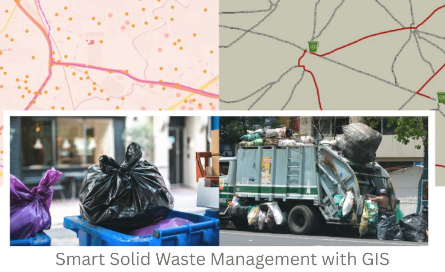
This is where GIS based Solid Waste Management becomes useful. It helps map the entire waste process ,from household collection to final disposal ,making it easier to monitor, control, and improve daily operations.
Why Waste Management Needs a Location-Based System
Waste collection does not happen in one place. It runs across different streets, wards, and zones at the same time. That’s what makes it difficult to manage efficiently.
Even with proper planning, there is always uncertainty:
- Which areas were actually covered?
- Did the vehicle follow the assigned route?
- Were any streets missed during collection?
- Why are complaints repeating in certain locations?
Without a location-based view, these questions are hard to answer.
A GIS Mapping Solution helps solve this by showing operations on a map. Supervisors can track routes, monitor vehicles, and identify gaps as they happen. If a vehicle deviates from its assigned path or gets rerouted, it becomes visible immediately.
This kind of visibility brings clarity into operations and reduces dependency on manual tracking.
What Is GIS Based Solid Waste Management?
GIS based Solid Waste Management is a system that combines location data with real-time operational data to manage waste collection more effectively.
Instead of working with separate reports, municipal teams can see:
- where waste is being collected
- how vehicles are moving
- which areas are covered
- where delays or gaps exist
It connects every part of the process into one platform, making Municipal Solid Waste management more structured and easier to control.
A well-designed solid waste management Solution using GIS allows teams to track operations visually rather than relying only on updates from the field.
How GIS Tracks Waste from Household to Final Disposal
One of the biggest strengths of GIS is that it tracks the entire journey of waste, not just collection.
Household Mapping
The process starts with mapping each household.
This helps:
- identify total households in each ward
- ensure complete coverage
- detect missed areas
It creates a strong base for operations.
Route Planning
Routes are designed based on real road networks, not assumptions.
This ensures:
- proper coverage of all streets
- no duplication between routes
- efficient vehicle movement
- Vehicle Movement Tracking
Vehicles are tracked in real time.
Supervisors can see:
- whether routes are being followed
- if any street is skipped
- if there are delays or deviations
If a vehicle takes a different route, it shows instantly on the map.
Collection Verification
Collection can be verified at each point using integrated systems.
This confirms:
- whether waste was collected
- when it was collected
- which vehicle handled it
Transfer Station Tracking
After collection, waste is transported to transfer stations.
GIS helps:
- track movement to these locations
- monitor usage of transfer points
- manage flow across zones
Final Disposal Tracking
Waste is then tracked to its final destination:
- landfill sites
- processing units
- recycling facilities
This creates a complete flow:
Household → Route → Vehicle → Transfer Station → Final Disposal
This is where GIS acts as a twin system ,tracking both physical movement and digital data.
Understanding GIS Layers in Waste Management
If you are managing waste collection operations, you already know that planning is only one part of the job. The real challenge begins when operations start on the ground.
You may have routes, vehicles, and teams assigned, but questions still come up every day. Which areas were actually covered? Why are complaints coming from the same locations? Are vehicles following assigned routes or taking shortcuts?
Without clear visibility, it becomes difficult to answer these questions confidently.
This is where GIS based Solid Waste Management changes the way operations are managed. Instead of relying on reports or manual updates, GIS organizes your entire system into layers, each showing a specific part of the operation on a map.
Let’s look at how these layers help in practice.
Key GIS Layers and How They Help
- Ward Boundary Layer
Helps divide the city into zones, making it easier to assign teams, track performance, and identify underperforming areas.
- Household (HH) Layer
Maps every household, allowing you to track coverage, identify missed streets, and plan routes based on actual density.
- Vehicle Route Layer (Planned vs Actual)
Shows assigned routes versus actual movement. Route deviations, skipped stretches, or delays become visible instantly, improving route discipline.
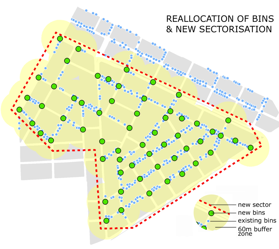
- Bin Location Layer
Tracks bin placement and usage. Helps identify overflow points, optimize placement, and reduce duplication.
- Transfer Station Layer
Monitors where waste is taken after collection, ensuring proper flow from pickup to disposal.
- Complaint Heatmap Layer
Highlights areas with repeated complaints, helping you identify patterns and fix root-level issues.
Bringing It All Together
When combined, these layers give a complete operational view. You can track coverage, monitor routes, identify gaps, and verify disposal ,all in one place.
This is the real value of GIS: clear visibility, better control, and faster decision-making for Municipal Solid Waste management.
Key Benefits of GIS for Municipal Solid Waste Management
When you start using a GIS based Solid Waste Management system, the impact is not limited to one part of the operation. It improves planning, monitoring, and overall control across the system.
For municipal teams and contractors, this means fewer daily uncertainties and more structured operations.
Here are some of the key benefits you can expect:
Improved Service Coverage
One of the most common issues in waste management is uneven coverage. Some areas are serviced regularly, while others get missed.
With GIS:
- every household and route is mapped
- missed areas are easy to identify
- coverage becomes more consistent
This ensures that services reach all areas without gaps.
Better Route Optimization
Routes often evolve over time and may not always remain efficient.
GIS helps:
- redesign routes based on actual road networks
- reduce overlap between vehicles
- minimize travel distance and time
This leads to smoother operations and better use of vehicles.
Reduced Operational Costs
When routes are optimized and inefficiencies are reduced, costs naturally go down.
You can expect:
- lower fuel consumption
- reduced vehicle wear and tear
- better utilization of resources
This makes the system more sustainable in the long run.
Stronger Monitoring and Accountability
One of the biggest advantages of GIS is visibility.
- you can track what is happening in real time
- field activities can be verified
- route deviations and delays are clearly visible
This improves accountability across teams and reduces dependency on manual checks.
Faster Response to Issues
With location-based data, problems can be identified quickly.
- complaint areas can be mapped
- service gaps can be addressed faster
- corrective actions can be taken during the same shift
This improves service quality and public satisfaction.
More Data-Driven Decisions
Instead of relying on assumptions, decisions are based on actual data.
- planning becomes more accurate
- resources are allocated better
- long-term improvements become easier
Overall Operational Control
When everything is connected ,households, routes, vehicles, and disposal points ,managing operations becomes much simpler.
You move from:
reactive management To: controlled and structured operations
Role of GIS in Smart City Waste Systems
As cities grow, waste management systems need to scale.
A GIS Mapping Solution helps municipalities plan for future expansion by:
- mapping new areas easily
- extending routes without disruption
- identifying infrastructure needs
Instead of reacting to problems, cities can plan ahead.
GIS supports long-term improvements in the solid waste management system India and helps build more structured urban systems.
Conclusion
Waste management today is not just about collection. It is about understanding how the entire system works, from household pickup to final disposal.
A GIS based Solid Waste Management approach brings this clarity. The system unifies all operational elements by connecting routes with vehicles, households, and disposal points.
Municipal teams can use their improved visibility and control to close operational gaps, enhance work efficiency, and provide more reliable services.
“Convexicon provides a practical and scalable solution for your Municipal Solid Waste management needs through a GIS-driven system that operates effectively in real-world situations.” To know more contact us at: +91 8800443333
FAQ:-
1. What is GIS based Solid Waste Management?
It is a system that uses mapping technology to track waste collection, routes, and assets for better monitoring and planning.
2. How does GIS help in solid waste management system India?
It improves route tracking, identifies gaps, and helps manage operations more efficiently.
3. What is a GIS Mapping Solution?
It provides a visual map of households, routes, and waste flow, helping manage operations effectively.
4. Can GIS track waste from collection to disposal?
Yes, it tracks the entire journey from household collection to final disposal.
5. Why is GIS important for Municipal Solid Waste management?
It improves visibility, accountability, and efficiency in waste operations.